What would you put on a glider HUD?
 I'm headed towards running the HUD device using this approach to start...
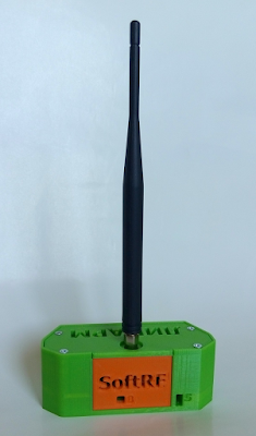
This is an augmented reality headset. For hardware, I'll use old smart phone of modest power; they can be had very inexpensively.
It would already have... 3D accellerometers for head tracking, USB, WiFi, bluetooth, graphics accelerators, lots of RAM and tons of Storage. Very easy to update, etc.
I'm looking at using TrackIR ($150) to do referential head-tracking relative to cockpit.
From here, I can either dumb down standard Android or root and embed the HUD/PFD software from there.
I'm currently playing the javascript 3D library three.js. I like it because it's simple and it's letting me explore what an augmented reality 3D PFD environment would look like.
This is super basic, but I built the horizon & pitch latter in 3D, the horizon is a ring, the pitch latter are ring-arcs. The pitch arcs would stay fixed to your aircraft's nose while you look around. That way you're not confused about which way is forward or if you're turning left/right.
 |
| Looking up to the right a little |
Other elements I'll be working on;
Flight Director - Best attitude to fly for your speed and heading. In a thermal shows best bank angle to optimize this thermal.
Traffic - Call out arrow pointer off-frame, sphere on-frame. Includes Call-sign, distance, direction, team mate or competitor, circling/cruising, rate of climb/altitude gained if circling, L/D if cruising.
3D Windsock - Gives the current best indicated three dimensional wind vector based on estimates of the current air. If this is done right, it will swing wildly in the vertical as you enter lift. Also gives the prevailing wind direction in 2D. (I'm imagining a cropped cone for the 3D windsock. It would have on it the magnitude (2.1 for 2.1 knots) which would orient in all three dimensions, and a simple arrow pointing into the prevailing 2D wind with it's magnitude.
Cloud Streets Assist - Thin gray parallel prevailing wind lines at large intervals going to infinity at the cloud-deck level. First is off your nose so you know exactly where to turn. Aid to visualize where the cloud street is likely to go from any given cloud or where you are now.
3D Trace - A line color coded for lift/sink of where you've been, just like turning on trace in Condor.
Core visualizer - Series of red, yellow, blue rings concentric on the likely current center, just bellow the glider, tells you how large the lift appears to be.
Centering-cue hoop - When significantly off-center places a horizon aligned rectangular hoop to fly through to indicate "go-straight" then a second angled hoop to resume the circle.
Airports/Land-Outs - airports are shown in outline for asphalt, green outline for grass (green/black won't show easily) and orange for land-outs. Includes distance, altitude to reach (factoring winds and dead-air)
FLIR overlay - when FLIR enabled, shows the head-mounted FLIR device's output. Here's one of several reverse engineered SDK for fetching the Seek Thermal output. I would pull that data and map it to a plane that matched the field of view. It will require calibration. A sighted cursor can lock a hot ground spot for the thermal estimator. The hottest spot observed in the last 10 seconds will also be displayed
Thermal Estimator - Given a marked ground location at some distance, draws a series of transparent vertical cones (wind shifted) for that hypothetical thermal if generated at the marked ground location. Estimates a route for your current location to intercept the center of probability and displays your altitude on reaching and your altitude if you diverted to the best land-out after reaching (Ie, what's your "out").
Best flap setting - best flap position for your speed when you're looking at the flap handle
I'd also like 2D side-ribbons for;
Altitude - MSL and AGL, Safety AGL (Altitude to best land-out), Task Altitude (need to complete task)
Speed - Current Rate, Best Speed, Vs, Va, Vne
Vario - Climb Rate, Average, MC, Total Climbed this thermal, Last thermal
Heading - Current, Task heading

Comments
Post a Comment